Frostburg, a Stop on the Road to History!
by J.R. Kirby
As we remember the western parts of Maryland as they may have been in 1776, it is important to note that the community, known as the City of Frostburg, did not exist until 1812 with the naming of the post office. It was not recognized as a legal entity by the State of Maryland until 1870. That does not mean that there are not important connections between Frostburg’s beginnings and the events related to the Revolutionary War and America’s Independence.
In 1754, George Washington led a group of Virginia militia west toward the frontier edge controlled by the French. His armed force would have passed near today’s Frostburg along well known Native American trails that had been surveyed several years earlier by Washington and another Colonial, Christopher Gist, in anticipation of westward expansion. The Colonials were always looking west, even when official dictates from London forbid any actual settlements.
Actions by members of Washington’s command, or maybe even George himself, led to a series of fights that helped spark, or at least expand, the ongoing war between France and England. The ultimate result for North America was the conflict commonly called the French and Indian War. In the summer of 1755, English Major General Edward Braddock led a sizable force of British regulars and Virginia militia from the mustering point at Fort Cumberland toward the French fortification known as Fort Duquesne at what is modern-day Pittsburgh. In command of the Virginia militia was Washington, having been denied a commission as a British officer. Their goal was to take the Fort and push the boundaries of the British Empire in North America west by forcing out their rivals, the French. An important part of the story is the construction of a road suitable for marching the army, including wagons and cannon, from Cumberland toward the French. The road—later named Braddock Road—followed the same Native American trails that Washington and Gist had surveyed earlier. It was considered one of the greatest military construction feats since the construction of the Roman roads throughout Europe. It also included a series of “camps” where the army would come together and reorganize for the next leg of the journey. Braddock’s second camp was known as “Martin’s Plantation” and was located in what is now Frostburg.
Several months later, just ten miles from Fort Duquesne, the French and their Indian allies ambushed the British forces, overwhelming them with the fighting tactics of the New World. Braddock was killed and many soldiers died either in battle or during horrible captivity. Some parts of the army were saved and later returned to the relative safety of Fort Cumberland under Washington’s leadership.
Ultimately the French and Indian War was a global victory for the British Empire. It also taught the American colonists, including George Washington, some very important lessons. First, British leadership would never consider Colonials, even “gentlemen” as equals. London society would not recognize Americans as Englishmen, only Colonials. It became one of the offensive issues that led to the movement for American Independence. Secondly, the War also taught Washington and others that the British army could be defeated in the field using the tactics of the New World. The King of England and Parliament would further alienate the Colonials by levying massive taxes on the thirteen colonies in order to recoup the debt incurred by the Crown during the French and Indian War. England would receive the benefits of being the superior power, but the colonies would have to foot the bill.
In addition to the lessons of the French and Indian War that were learned by the Founding Fathers in the push for independence, the remnants of the Braddock Road, constructed by the army in its failed assault on the French, became one of the most important westward routes for the growing new American nation. This important route west ran through what would become Frostburg.
In the years after the Revolutionary War, large tracts of land in the western parts of the Maryland were set aside for veterans of the Revolutionary War. In the area of what would become Frostburg, some of those tracts were bisected by the newly planned National Road. This first-of-its-kind public investment, funded by the U.S. Congress in 1806, created a permanent transportation route from the eastern portions of the nation into the Ohio Valley.
Such roads required numerous stops to afford the care of animals, feeding of travelers, and other related commerce. Travel after sundown was impractical and dangerous. Industrious businessmen such as Meshach Frost saw the opportunities in the developing enclave and acquired portions of military lots along the new National Road, built a tavern, and began the layout and development of a town to support the traffic heading west. In 1812, the town, known at the time as Mount Pleasant, would be renamed Frostburg in homage of Frost’s contributions.
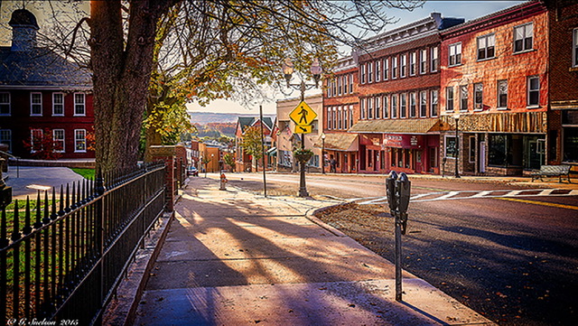
The National Road followed the route of Braddock Road to a point, but deviated for many stretches for various reasons. In the area of Frostburg, Braddock Road is generally believed to have passed through the southern edge of the community, while the National Road took a slightly less steep, northern route. The Road is the location of much of U.S. 40 and in Frostburg it is actually named Main Street, passing directly in front of the Frostburg Museum. With the completion of the National Road, commerce and development greatly expanded, transforming Frostburg into a thriving business community.
It is true that Frostburg as we know it today did not exist in July 1776. It was part of the vast, unsettled parts of the Maryland frontier west of Cumberland. But the truth is that the vast majority of America is just like us, awaiting explorers and settlers as the country expanded westward. We may not have been there at the signing of the Declaration of Independence, but the work, dreams and sacrifice of the Founders was reflected in our community’s beginnings and throughout its history.
After the Revolutionary War, there was a convergence of available land tracts originally set aside for War veterans and the new National Road. Frostburg, a natural stopping point for travelers, was selected by the Frost Family to build a tavern for those travelers and to begin laying out a settlement, that would be initially named Mount Pleasant, but changed to Frostburg in order to qualify for a Post Office. Connect the Dots:
George Washington and others survey routes west using Native American trails as part of the quest by the colonies to expand west into the Ohio Territory.
General Braddock’s Army builds an amazing road west from Cumberland toward Pittsburgh along the same trails surveyed by Washington, Gist and others. The trails and the Road go through the area that would become Frostburg.
The end of the French and Indian War planted the seeds of “Independence” among the colonials, base in part by the way they were treated by the British and the onerous taxes levied on them by Parlement to pay for the war debt.
The road built by Braddock became one of the most important land routes for new settlers. The Road passes through Frostburg.
To commemorate the 250th anniversary of the signing of the Declaration, the Frostburg Museum Association will participate in the events now being planned by our City government. We will work on new programming to provide a visual understanding of the elements of Colonial American that led to the placement and development or our community. Discussions are underway about a “timeline” to connect the Native American trails to the National Road and the location of a small settlement by the Frostburg family. We will use this new programming to connect students from nearby Elementary Schools, Mountain Ridge High School and Frostburg State University. We will work with WFWM, Public Radio on the campus of FSU, to create short stories to be recorded by students and broadcast to the entire Tri-State area.
The most visible connection for us is perhaps the Braddock Stone, a primitive marker on the Braddock Road from the period after the French and Indian War. The Braddock Stone now rests in a protective enclosure in the front court yard of the Museum at 50 East Main Street. The provides the connection to all the parts of our story and the various connections to a very young Col. George Washington.
The story will continue to be told and lived. Why not come a see it for yourself.